Parallel computing in GIS
Parallel computing speeds up programs, allowing the usage of large-scale and high-resolution data in a reasonable time. 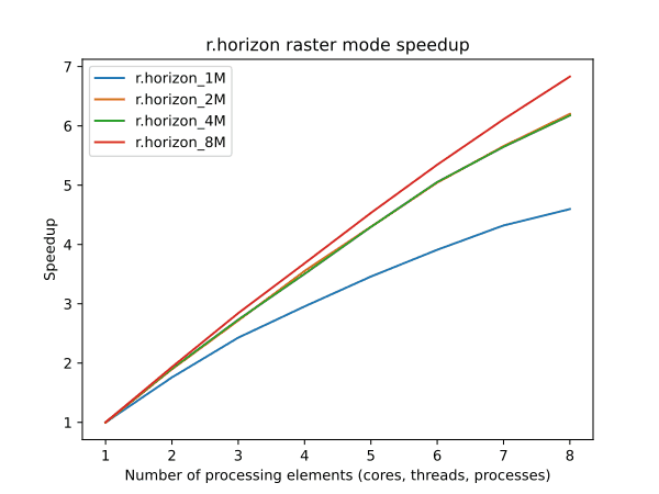
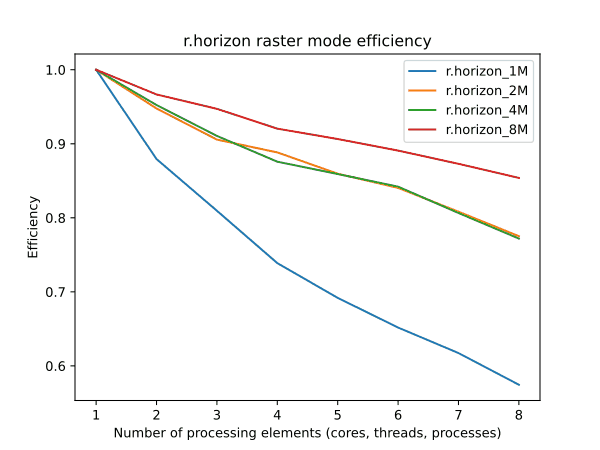

Parallel computing speeds up programs, allowing the usage of large-scale and high-resolution data in a reasonable time.
Cutting-edge deep learning models are employed to predict riverbed topography for engineering applications. 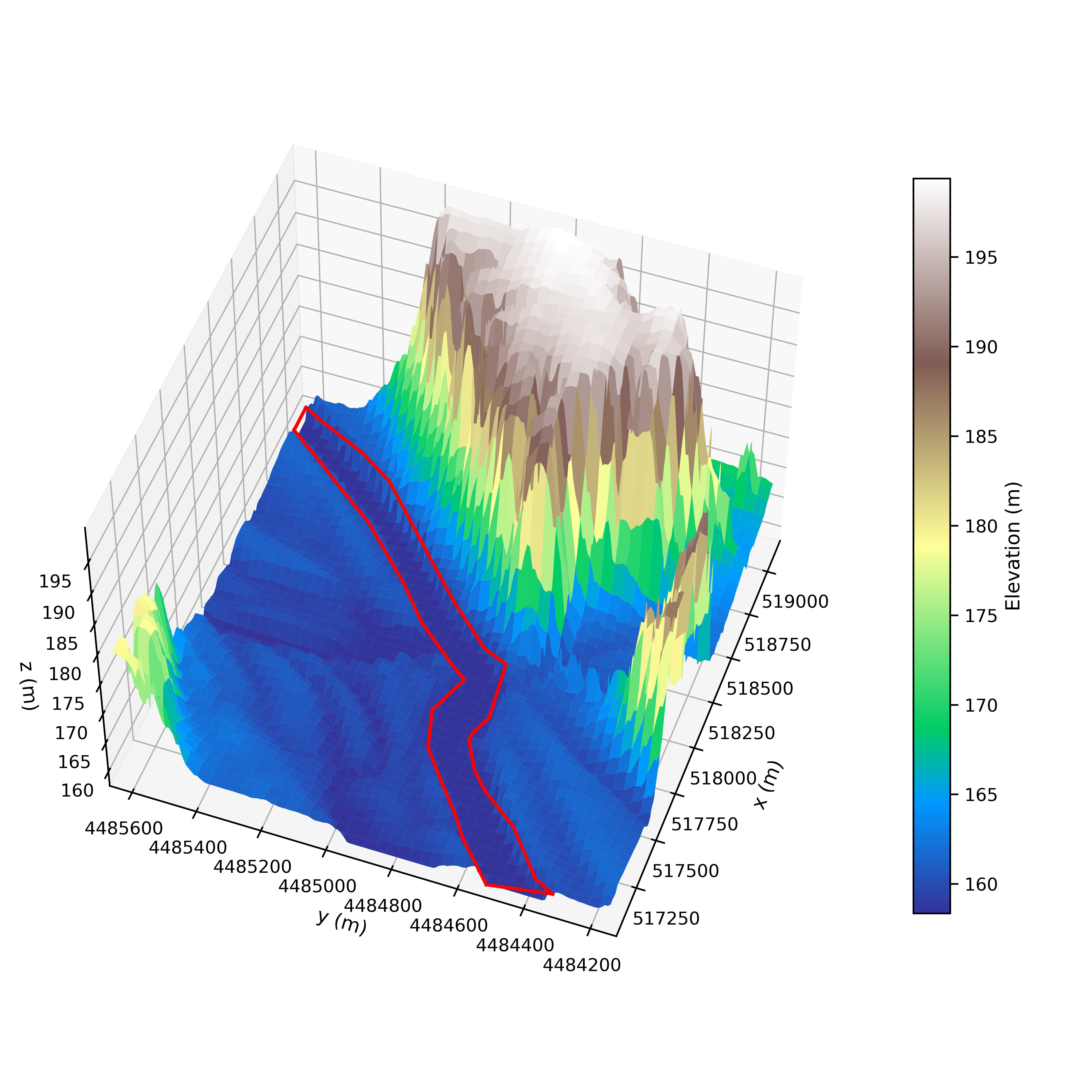
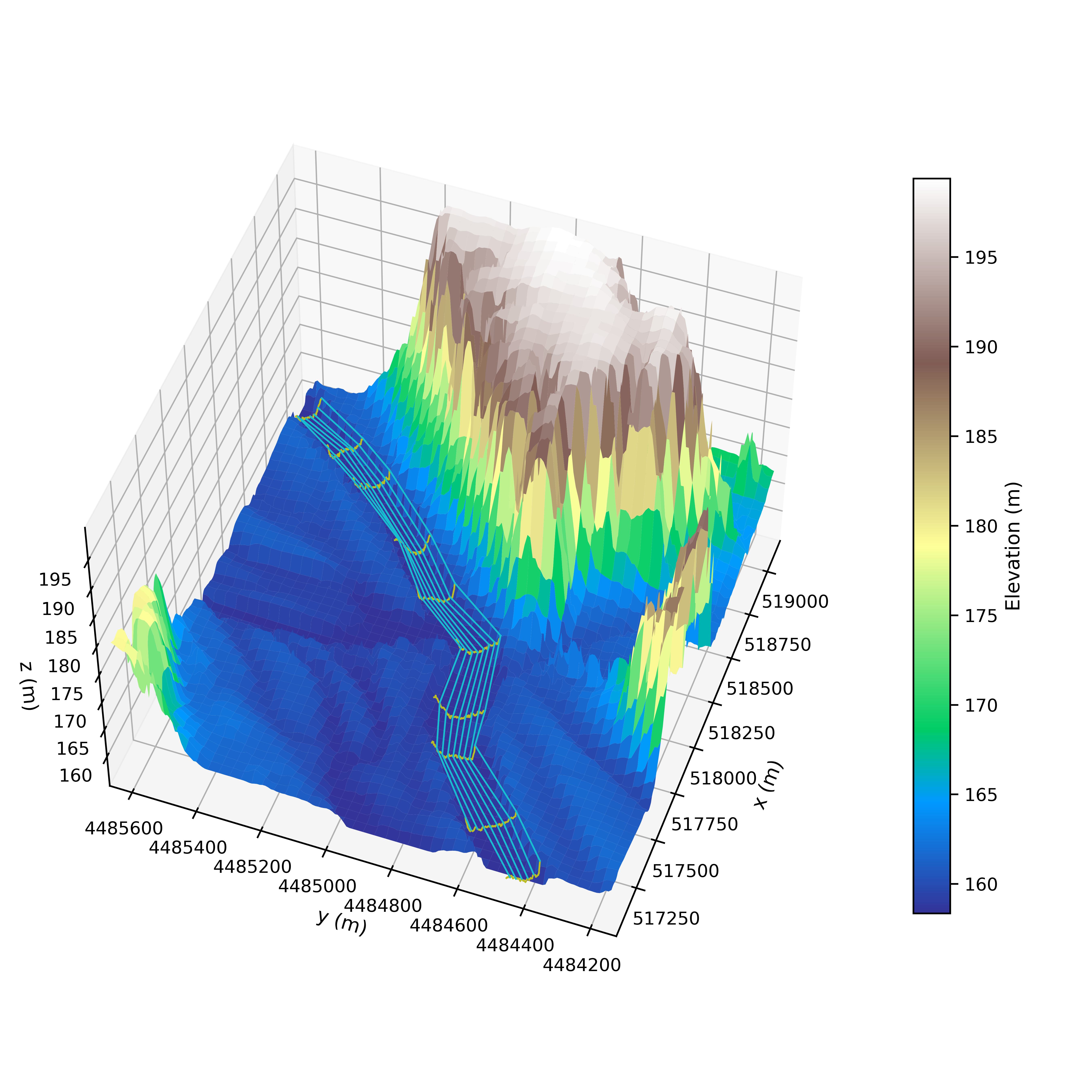
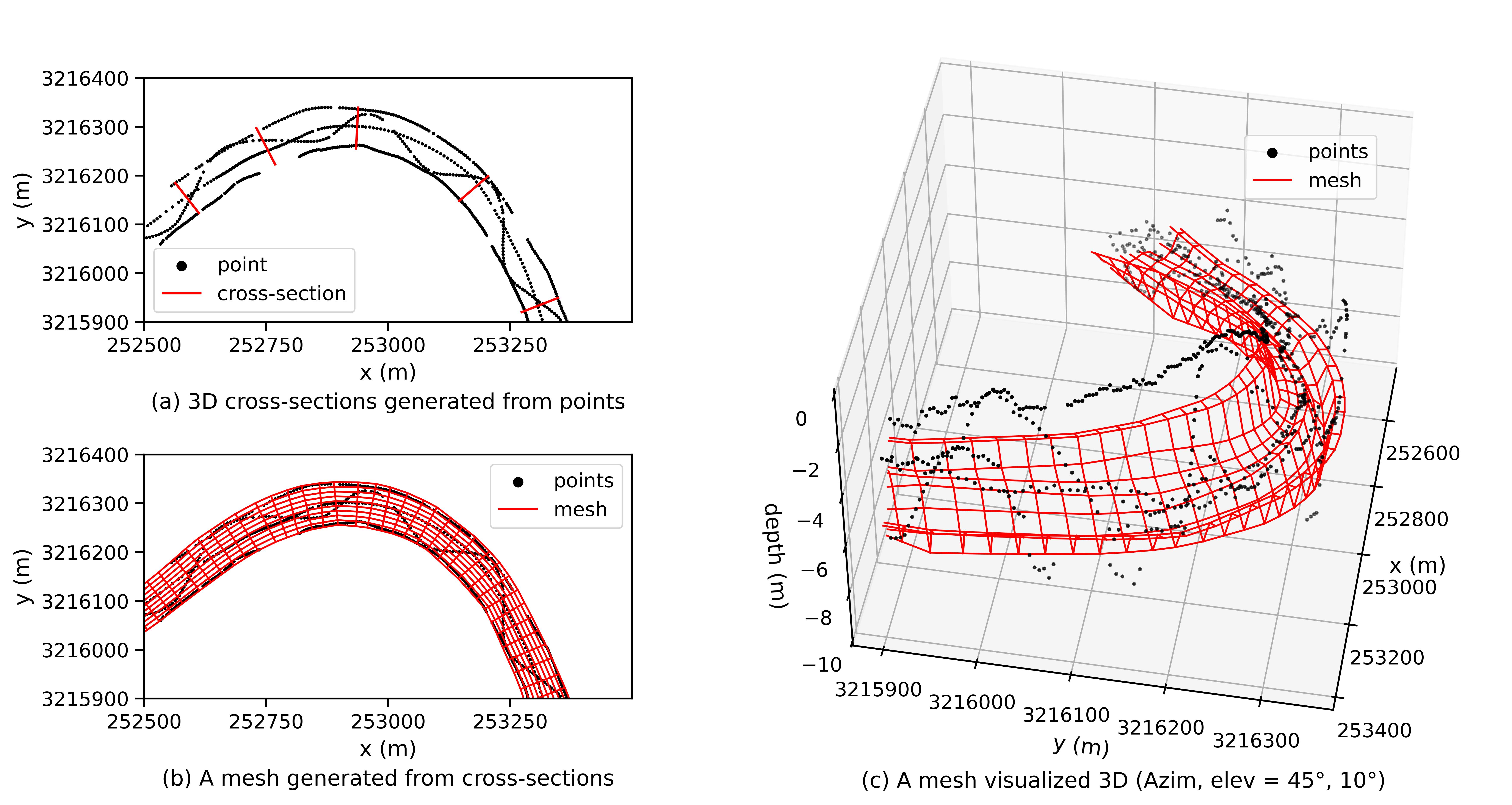
Python packages are develped to automatically load and process geospatial data related to river hydraulics.